Thanks to satellite images from Google
Earth, Swiss police were alerted to a cannabis plantation outside of a small village
in Eastern Switzerland.
Raperswilen is a sleepy village in the canton of Thurgau, that hardly anyone has heard of, and might have
remained that way; had it not been for Google's clear satellite imagery and diligent
police work.
In part of a larger police operation last year - that resulted in
the arrest of 16 people and seizure of over a ton marijuana - Zurich police narcotics
specialist, Norbert Klossner claims this was an 'interesting chance discovery'.
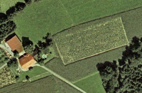
Very interesting indeed; and although the 'cannabis plantation',
measuring almost two acres, has since been ploughed over you can view the exclusive
pictures here.
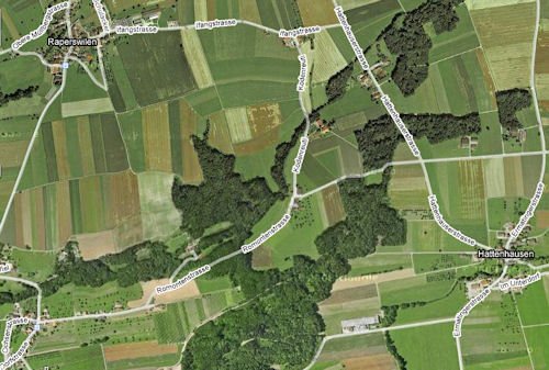
For casual passers-by, the fields around Raperswilen and Hattenhusen
would all seem pretty normal.
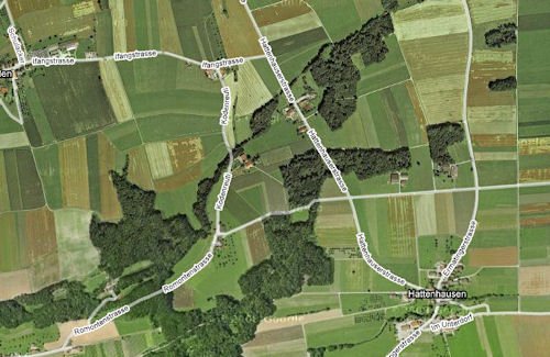
Closing in on Google's satellite
maps reveals an interesting change in the pattern of fields.

Then, hidden among the cornfields, something more than a farmer's
back-garden starts to take shape.
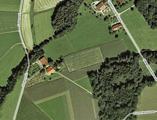
Police officers used Google Earth
to locate the address of two farmers, suspected of being a part in the drug operation they
were investigating, then spotted the illegal crop.
Zoom in a little more and the 'plants' are clear to see.
Officials told reporters that between 2004 and 2008, the gang is
believed to have sold up to seven tons of the drug; illegally earning three to ten million
Swiss francs a year.
Gabi Alkalay, the prosecutor for the case, plans to complete her
criminal investigation in February, then expects to charge the 16 suspects and seek prison
sentences for all of them.
By Michel - with the
help of Google Maps.

TravelTweet
TravelTweet Directory:
Directory of travel tweeps on Twitter.
Add a Business Listing - Add a Destination Guide - Add a Place to Stay.
 If you find Travel Notes useful, please take a moment to like us on
Facebook and share with your friends on social media. If you find Travel Notes useful, please take a moment to like us on
Facebook and share with your friends on social media.
Meta-Travel Blogging
- Top
Travel Blogs
- Travel Notes Directory.
|

 Travel Writer, Photographer and Internet Publisher")